Showing posts with label Ireland. Show all posts

Wednesday, 15 May 2013

Oliver's Army (original), The effect of Cromwell's conquest of Ireland and the Down Survey

Does the faith of landowners matter? How did the transfer of property in Ireland following Cromwell's (re-) conquest of Ireland effect the landscape? Maps make questions as well as answer them.
A really excellent resource on the Down Survey of Ireland has been produced by Trinity College Dublin
http://downsurvey.tcd.ie/index.html   Of particular use for the landscape historian are the maps of Barony surveys (where they survive, some were destroyed in the 18th-c), which include main landuse (arable, boggy, etc. as well as placenames http://downsurvey.tcd.ie/down-survey-maps.php#bm=Corcumroe&c=Clare&indexOfObjectValue=-1&indexOfObjectValueSubstring=-1 

Ireland

Catholic Land (16.6%)
Protestant Land (69.8%)
Common and Unprofitable Land (1.6%)
Not in Survey (12.0%)
Percentage of land ownership uses modern measurements, not the reported Down Survey values.
1641
1670


Friday, 4 January 2013

Wolfland - Ireland and the wolf through history

 "Wolfland" is a 2-part documentary series looking at our fear and fascination of the Wolf in Ireland’s history on Monday the 7th of January @ 19.30 on RTE. This RTÉ / BBC co-production recounts Ireland's complex relationship with the wolf from pre-history to the plantations.

The programmes feature exhibits in the Nation Museum of Ireland: Natural History and interviews in the NHD building at Beggars Bush looking at wolves and Irish wolfhounds with Nigel Monaghan Curator of the NMI: Natural History.
BBC Two Northern Ireland will broadcast the first programme on Friday 11th January 2013 @ 21.00hrs (Northern Ireland only - not to Britain).The final part is to be broadcast the following week on both channels.

http://www.rte.ie/tv/programmes/wolfland.html   http://www.bbc.co.uk/programmes/b01pwwdc

WOLFLAND - a New RTÉ/BBC Irish language two part documentary that explores our fascination and fear of the Wolf.
There was a time, when over 20,000 wolves roamed Ireland. As super predators they are a natural part of the landscape and ecosystem and are deeply embedded in many of our famous myths and legends.
In this documentary series, Dr. Éamonn Ó Ciardha looks at our complex relationship with the Wolf, taking us on a hair raising journey into Ireland's past, exploring the background to what many of us experience as an instinctive fear of the Wolf or Mac Tíre - son of the land. A land that was in increasing turmoil at the turn of the 16th century as plantation settlers began to arrive. For them, the wolf became a fearsome symbol of this wild and dangerous land.
Large-scale farming and deforestation saw the wolf rapidly losing its hunting and breeding grounds. But war, rebellion and fighting between settlers and a growing number of Irish rebels provided rich pickings for wolves - preying on livestock and scavenging on the fallen. The terrified settlers called their new home "Wolfland".
The first programme in the series looks at the traces and tracks the wolf has left with us in Ireland, within the landscape and place names, the language, the literature and the mythology. Roaming the land for some 20,000 years the wolf was certainly feared, but also revered in Ireland. It was a creature that symbolised strength and courage to the native Irish, but to the arriving settlers from the 16th century onwards the wolf was a dark and savage creature representing all that needed tamed in Ireland.
In the second programme we look at the escalating fighting between the settlers and the Irish as mass plantations began across Ireland and the role the wolf played in the bloody warfare of the Cromwellian era. Documentary evidence is uncovered of early propaganda linking the rebel Irish, the catholic priest and the savage wolf and of a campaign to rid Ireland of all three.
Filmed across Ireland, this series is a fascinating mix of Irish history and natural history. A compelling look at the plantation era, charting the importance of the wolf in Ireland's history and its ultimate extinction.

Wednesday, 19 December 2012

A saunter around Clarinbridge, in Ireland


Just a wander around Clarinbridge -- Just one thing to point out. At the last picture there is a view into the Burren and on top of the hill, you can just see a cairn. Cairns, tombs etc. on the north side of the Burren overlook Galway Bay, whereaas there are no such sited cairns and tombs on the Atlantic Coast (I found out when doing the Clare Historic Landscape Characterisation. see http://www.heritagecouncil.ie/fileadmin/user_upload/Publications/Landscape/Landscape_Clare/area_1.pdf
 in http://www.heritagecouncil.ie/landscape/publications/landscape-character-assessment-of-co-clare/

Created with Admarket's flickrSLiDR.

View Larger Map

Tuesday, 11 October 2011

Coral Strand, Carraroe, Connemara, Ireland

Trá an Dóilín (Coral Strand) coral sand
http://www.panoramio.com/photo/53558688 

Coral Strand or Trá an Dóilín  is made from the excreted mineral (1/3 calcium carbonate) of  corallines  red algae, rather than true coral. It has been used in the past to sweeten the acidic local soils, and is a soil conditioner, BUT it is a non-renewable resource as the stuff is excreted at a far slower rate than it could be used.  
Trá an Dóilín ( Coral Strand ), looking south
Click on http://www.panoramio.com/photo/53558692  to see location


An Cheathrú Rua the Irish for carraroe, means the Red or Ruddy Quarter and despite being a townland (baile) it derives the first part from the Irish name for a quarter-division of a wider baile / community. The ruddy part refers often to poor land, through the browning or bronzing of dead vegetation, possibly. 


Connemara,  Conmaic ne mara is commonly translated as the tribe of Cormac by the sea. It has never had any official standing but refers to the wilder district of Connacht and County Galway which stretches west into the Atlantic.  Despite - or because - of official neglect it retained a strong local identity, large Irish-speaking communities, its own breed of horse and a tradition of personal and communal independence. 

Monday, 10 October 2011

The Liberator and one of the 60 great (public) places (on the planet)

"The Liberator" in Ennis by david sankey
"The Liberator" in Ennis, a photo by david sankey on Flickr.


O'Connell Street

County Clare
Ennis, Ireland
Contributed by Project for Public Spaces ---translated into English by sankey --- for the original, go to http://www.pps.org/great_public_spaces/one?public_place_id=173

Along with the two other main streets that branch off of Ennis' central O'Connell Square, O'Connell street bustles with activity at all hours.

Why It Works Cars, lorries, bicycles and pedestrians are all accommodated naturally. The well-cared-for street has everything from pubs and music halls to department stores and chemists, making it relevant day and night, for all ages and interests. Although the scale of the street is quite narrow, including pavements, cars and walkers are treated well. Beautiful hanging plants adorn the lamp posts, and cobblestoned crossings and intersections indicate where to cross the road.

What Makes O'Connell Street a Great Place?
  • The scale of the town centre is easily walkable
  • Although the scale of the street is quite narrow, including pavements, cars and walkers are treated well, beautiful hanging plants adorn the lampposts and cobblestoned crossings and intersections indicate where people cross the street.
  • The well-cared-for street has everything from pubs and music halls to department stores and chemists, making it relevant day and night, for all ages and interests. O'Connell Square, at the top of the street, is a natural gathering place.

History & Background

Ennis is a county seat with a growing population, estimated at approximately 20,000. One of the larger cities in Ireland [surely not - definitely NOT a city merely a county town, DS], it is a cultural center as well, hosting serveral of Ireland's best-known traditional music festivals. Ennis blossomed as a market town in the late 1700s.
O'Connell Street and O'Connell Square honour Daniel O'Connor, an MP for Clare in the mid-1800s and pivotal Catholic politician and leader. A statue of O'Connell stands in the square, on the site of the old courthouse. [O'Connell Street was formerly "Gaol Street" Jail Street. DS] The town was founded in 1208 by the O'Briens, who built a castle on the edge of the modern town, which lies on the River Fergus. The O'Briens ruled until they vacated Ennis for Bunratty Castle.

Related Links:

Irish Landscape books - worth a squint - nice presents or borrow from your library

I've just received my copy and am reading Valerie Hall's fascinating recently published book on the Irish Landscape
The Making of Ireland's Landscape: Since the Ice AgeThe fascinating story of Ireland's changing landscape begins over 11,000 years ago as the last Ice Age ended. Through a combination of authoritative text and photographs, this easily accessible book describes how the landscape of Ireland has been shaped. It tells the story of how natural forces as well as people influenced the landscape, its plants and animals, and traces the history of the wild places as well as the development of the farmed landscape. The photographs, many of which are of modern subjects, emphasise how the past Irish landscape continues to resonate today. - its says 'ere, DS 

  • Publisher: The Collins Press
  • Publication date: 10/04/2011
  • ISBN-13: 9781848891159
It has a hard act to follow in Mitchell and Ryan's Reading the Irish landscape - which I've long treasured
Reading the Irish Landscape by Frank…
The authors seek to produce a total insight which synthesises geology, geography and archaeology, with botany and zoology also covered to an extent. Remarkably, they shed stiumulating light on many aspects of the subject by comparisons with parallels elsewhere in the world; thus an early painting of aboriginal fishing in New South Wales, and an early 20th century photo of drying fish in Newfoundland, are set alongside a photograph of Aran Islanders launching a curragh. With this cross-disciplinary approach, technical language is both necessary and problematic; the solution constantly striven for is to keep jargon to a minimum and to define specialist terms as they arise in the text. To a large extent this works; the book can be read by the intelligent lay reader without constant referal to glossaries. 

The later section takes the reader through the effect of human activity on the landscape from prehistory to the present day, in a survey well-illustrated with aerial photos and contemporary prints. ...said one reader

ISBN 1860590551 9781860590559 0946172544 9780946172542

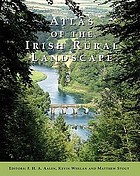
or Fred Aalen et al's Atlas of the Irish Rural Landscape
Atlas of the Irish rural landscape
harnessed the expertise of dozens of specialists to produce an exciting and pioneering study which has two basic aims: to increase understanding and appreciation of the landscape as an important element of national heritage and to provide a much needed basis for landscape conservation and planning. The complex assemblages of features, physical and human, which gives landscapes their distinctive regional character are examined in relation to man-made elements, such as field and settlement patterns, enclosure methods, rural buildings, demesnes, villages and small towns, archaeological/historical monuments, woodland, bogs, communications, and industrial archaeology.

ISBN:9781859184592 1859184596