Well most places in the midlands are landlocked, it "goes with the territory". However, it is far from "remote" - in fact I've never heard such rubbish. Ludlow's on a train line, it has excellent road connections. Compare for instance London. Going from one side of London to another, by tube, mainline rail and car, more-or-less takes two hours. Yet -for instance- car from my home of Kingswinford to Ludlow (much further away than the other side of London) takes about an hour. It's doable for a curry and a stroll around on a summer evening. Not only that - you can stop off at Brdgnorth or Bewdley (get some Troach from Teddy Gray's)
Of course, not everyone is going to start from Kingswinford - but thousands and hundreds of thousands live within a similar distance.
![[View at Tenby, Wales] (LOC) by The Library of Congress](http://farm3.static.flickr.com/2548/3752414556_003363f785.jpg)


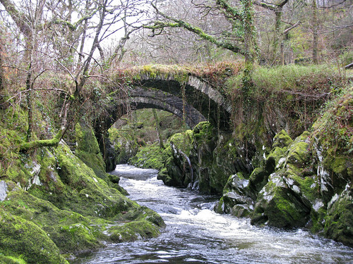
![[Roman bridge I, Bettws-y-Coed (i.e. Betws), Wales] (LOC) by The Library of Congress](http://farm4.static.flickr.com/3429/3752440348_a6fbb283bf.jpg)