 |
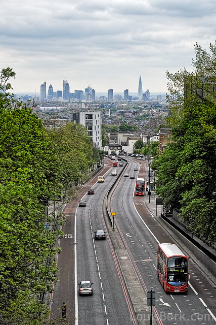
| Original Photo b y Louis Berk http://www.flickr.com/photos/louisb/8753696624/ |
View Larger Map
This is the view from a bridge over a cutting taking the A1 - North Road . The name Archway Bridge referred to the original...
 |
| Original Bridge |
The road heads directly toward the City of London. The former walled area of which can be seen by the distribution of high-rise office blocks, in what might be termed a "Hiddenscape", much as the hight of tower blocks in New York reflects the solid geology beneath the ground. Though in the City of London's case, it reflects a desire to maintain the City as a Central Business District of global significance - and one that retains a unique electoral system. Power and historical processes being at least as significant as natural geology
 |
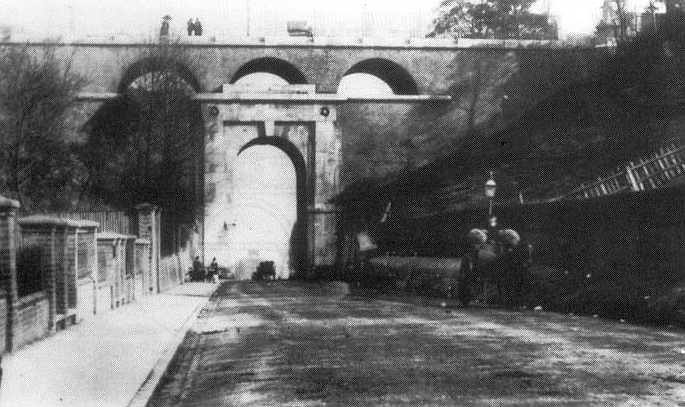
| Archway 1912. The scene is still dominated by horse traffic. |
....from an earlier post:
The reason why London exists, why it is here and not there, and what it is, rarely comes to the mind of the millions of Londoners, still less into the mind of policy chiefs, planners and politicians. Essentially, it is historical. London grew from the lowest point downstream that Romans could build a bridge across the Thames - a difficult task since it involved not just the bridge over the river but also a causeway and smaller bridges crossing islands in a periodically flooded floodplain along the line of the Borough, in Southwark. It also coincides with the then highest point upstream that Roman boats could use the tide to bring goods upstream. The line of the North - South crossing can still be seen, as the Roman Road from the north followed a shallow ridge to the river, it has now sprouted enormous buildings. The deep historical structure is still a pervading influence
Click for a map of Roman London imposed on modern street map Picture below is of the road entering the City from Bishopsgate
Click for a map of Roman London imposed on modern street map Picture below is of the road entering the City from Bishopsgate
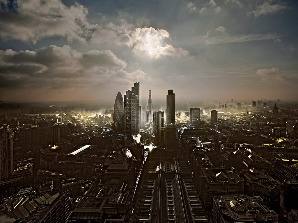 |
| The line of the Roman road to Lincoln and York - Ermine Street - as it enters the walled city (marked by tall buildings today) and heads towards the river crossing to Southwark (Shard, under construction, now finished) |
Map showing direction of photograph photo by Howard Kingsnorth (website) http://www.guardian.co.uk/world/picture/2011/jan/28/london#zoomed-picture http://www.howardkingsnorth.com/urban.html
No comments:
Post a Comment